Sophisticated Tools Powering Local Progress
At Alma Ag Drones, we recognize that superior results are only possible when professional expertise is paired with industrial-grade equipment. The Bacon County region, characterized by its sprawling timber tracts and its status as a vital agricultural hub, requires technology that can withstand the heat and humidity of the Coastal Plain while delivering surgical accuracy. We don't simply operate drones; we manage a mission-critical fleet that undergoes constant modernization. Our hardware is specifically curated to navigate the unique environmental demands of Southeast Georgia—from the dense pine canopies of the flatwoods to the precise rows of our local blueberry and tobacco acreage.
Partnering with us allows regional enterprises to eliminate the steep financial risks of technology ownership. In the unmanned aerial vehicle (UAV) sector, hardware becomes legacy equipment almost as soon as it is unboxed. By leveraging our services, Alma businesses gain the power of a multi-million dollar aviation department without the crushing weight of capital investment, constant maintenance, or specialized pilot training. Whether you are overseeing a 10,000-acre timber cruise or a high-stakes infrastructure project, we ensure it is executed using the most secure and capable systems currently available on the global market.
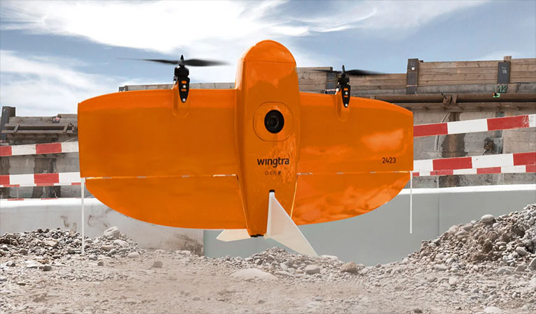
WingtraOne Gen II: Redefining Large-Scale Geospatial Surveys
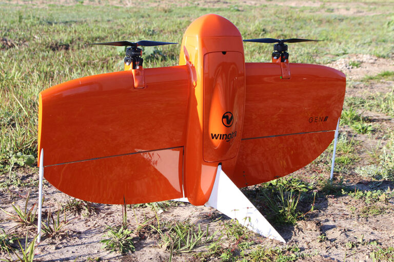
When the mission involves vast stretches of South Georgia terrain, the WingtraOne Gen II is our primary asset. In a region where time is money, the ability to cover massive acreage quickly is essential. The WingtraOne is a sophisticated "tailsitter" VTOL (Vertical Take-Off and Landing) aircraft. This design allows us to launch from confined spaces—like a narrow logging road or a gap in the pines—without needing a runway, yet once airborne, it transitions to high-speed forward flight. A single Wingtra deployment can map 700+ acres in one session, providing a coverage rate ten times higher than a standard quadcopter.
This speed is matched by extreme metric precision. Our WingtraOne units are outfitted with high-end Post-Processed Kinematic (PPK) GNSS technology. By synchronizing this with our localized Emlid base stations, we provide centimeter-level absolute accuracy across your entire project site. For Alma-based engineers and land developers, this translates to survey-grade digital twins delivered in record time, eliminating the need for labor-intensive manual ground control points.
XAG P150: The Future of Aerial Crop Protection
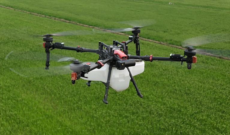
For precision application in the agricultural and environmental sectors, we utilize the XAG P150—the pinnacle of heavy-lift drone engineering. In the sweltering climate of Bacon County, the window for effective fungicide or insecticide application is incredibly narrow. The P150 is designed for the high-duty cycles of the Coastal Plain, featuring a massive 70L payload capacity and high-output centrifugal atomization. Unlike traditional hydraulic nozzles that produce uneven droplets prone to drifting, our atomization system creates a uniform, targeted mist that ensures every ounce of product reaches its intended destination.
The technical edge of the P150 lies in its aerodynamic downwash. As the aircraft hovers and moves just above the crop line, the massive rotors create an air vortex that actively "flips" the leaves. This allows the spray to penetrate deep into the canopy and coat the undersides of the foliage—areas ground rigs often miss. For local growers of peanuts, cotton, and blueberries, this 360-degree coverage is the gold standard for disease prevention. We transform days of grueling ground-based spraying into a few hours of automated, highly efficient aerial application.
| UAS Feature | Benefit to Alma Farmers |
|---|---|
| Variable Rate Application | Apply chemicals only where needed based on high-resolution map data, reducing input costs. |
| Zero Soil Compaction | Effective spraying immediately after heavy rains when ground rigs would cause permanent soil damage or get stuck. |
| Multispectral Imaging | Identifying "hidden" crop stress and nutrient deficiencies before they are visible to the naked eye. |
| Swarm Technology | Multiple drones working a single field in coordination to cover large regional acreage with maximum efficiency. |
Blue UAS: Military-Grade Security for Critical Data
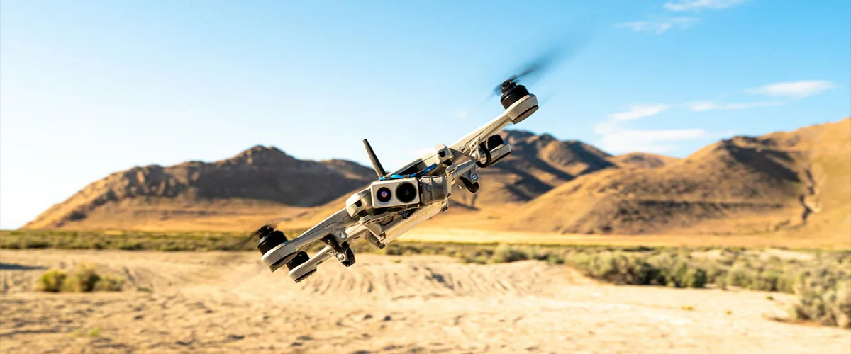
In an era where data sovereignty and cybersecurity are paramount, the origin and security of your drone hardware matter. Alma Ag Drones is dedicated to protecting the integrity of regional data. Our primary survey fleet consists of Blue UAS Certified platforms—a rigorous standard vetted by the U.S. Department of Defense. This certification guarantees that our equipment adheres to the highest protocols for supply chain transparency, data encryption, and cybersecurity. Whether we are inspecting a municipal water tower or mapping a private utility easement, you can trust that your geospatial intelligence is shielded from unauthorized access. We provide a secure alternative to the significant risks posed by unsecured, consumer-grade aerial platforms.
Actionable Intelligence: Turning Raw Imagery into Results
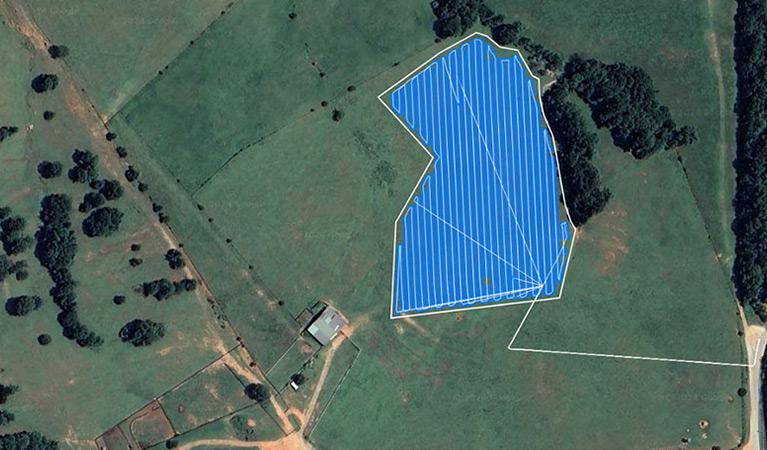
The flight is only the beginning of our value chain. The true power of our service lies in our sophisticated data processing workflow. We utilize the industry-leading PIX4D software ecosystem, featuring PIX4Dmatic for massive industrial photogrammetry and PIX4Dfields for rapid, in-season agricultural assessments. These high-performance tools allow our analysts to convert terabytes of raw data into high-resolution orthomosaics, 3D point clouds, and multispectral health maps. We deliver final products in the exact CAD, GIS, or farm management formats your team requires, ensuring that aerial intelligence flows seamlessly into your daily operations.
Integrated Sensor Technology
MAP61 / RGB61
Full-frame Sony sensors delivering ultra-high resolution for forensic-level mapping and 3D modeling.
Riegl miniVUX LiDAR
The gold standard for "seeing through" Georgia pine canopies to map the true bare earth terrain with millimeter precision.
MicaSense RedEdge-P
Advanced multispectral sensors providing the deep-layer crop health analytics needed for variable rate prescriptions.
Local Support & Reliability
Our Alma-based operation maintains a full inventory of redundant aircraft and critical spare parts. We guarantee uptime—if a system needs service, a backup is ready to launch immediately to keep your project on schedule.
Request Technical Brief